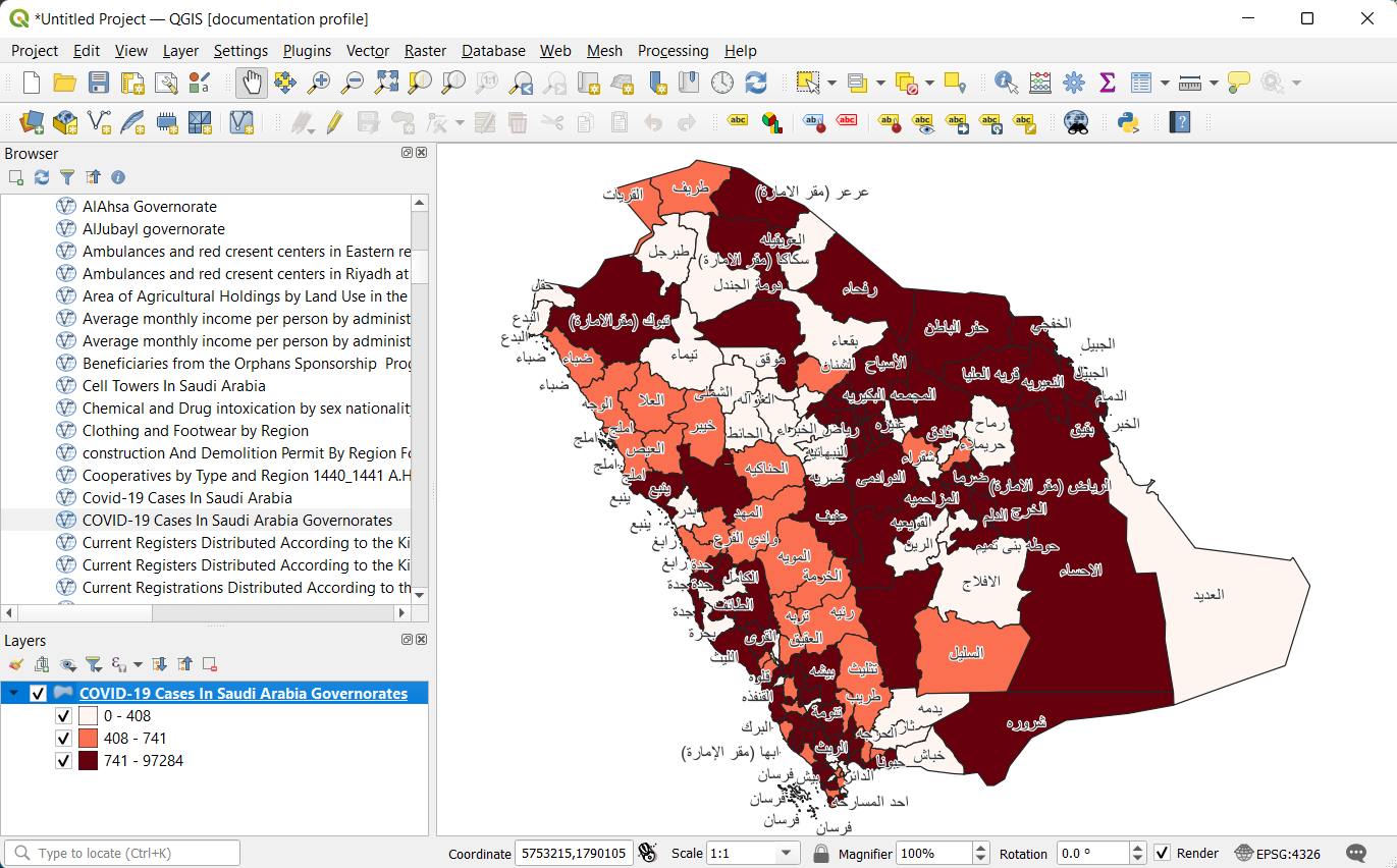
Get Map Service API Reference
Estimated reading time : 3 minutes
Map Service API
The Map Service API allows you to retrieve WMS and WFS generated by the platform. You can use some libraries like Leaflet or MapLibre GL for JavaScript, Android or iOS to add a map to your website.
Endpoint to use
If you need WFS URL, you should use this endpoint. We are supporting both WMS and WFS.
https://data.tabaqat.net/geoserver/wfs?access_token=your-tabaqat-access-token&AcceptLanguages=en&request=GetCapabilities
- map service type: you can set the map service to WFS or WMS.
- authentication token: create your access token on the platform.
- language: you can choose Arabic language or English language by setting this value to en for English or ar for Arabic.
Note
Importing WFS layers is a Premium feature.
Step 1
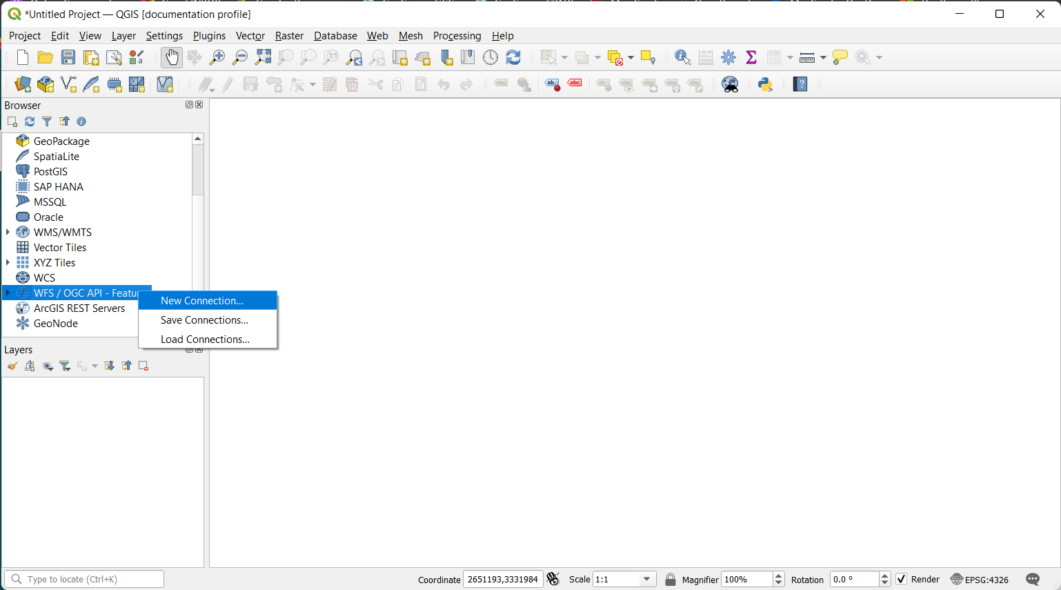
To import your WFS in QGIS, go in the Browser Panel, find WFS/OGC API-Features, right click on it and click on New Connection...
Step 2
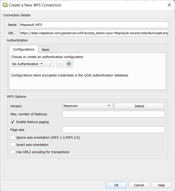
A new window opens with settings to configure:
- Name: Name of the layer you will create. We will use tabaqat for our example, but you are free to choose what ever you want.
- URL: Path to the WFS file or HTTP link to import. We will use a HTTP link from tabaqat here. Other settings are left empty in our case. Your new connection will be added in WFS/OGC API-Features section on Browser Panel.
Step 3
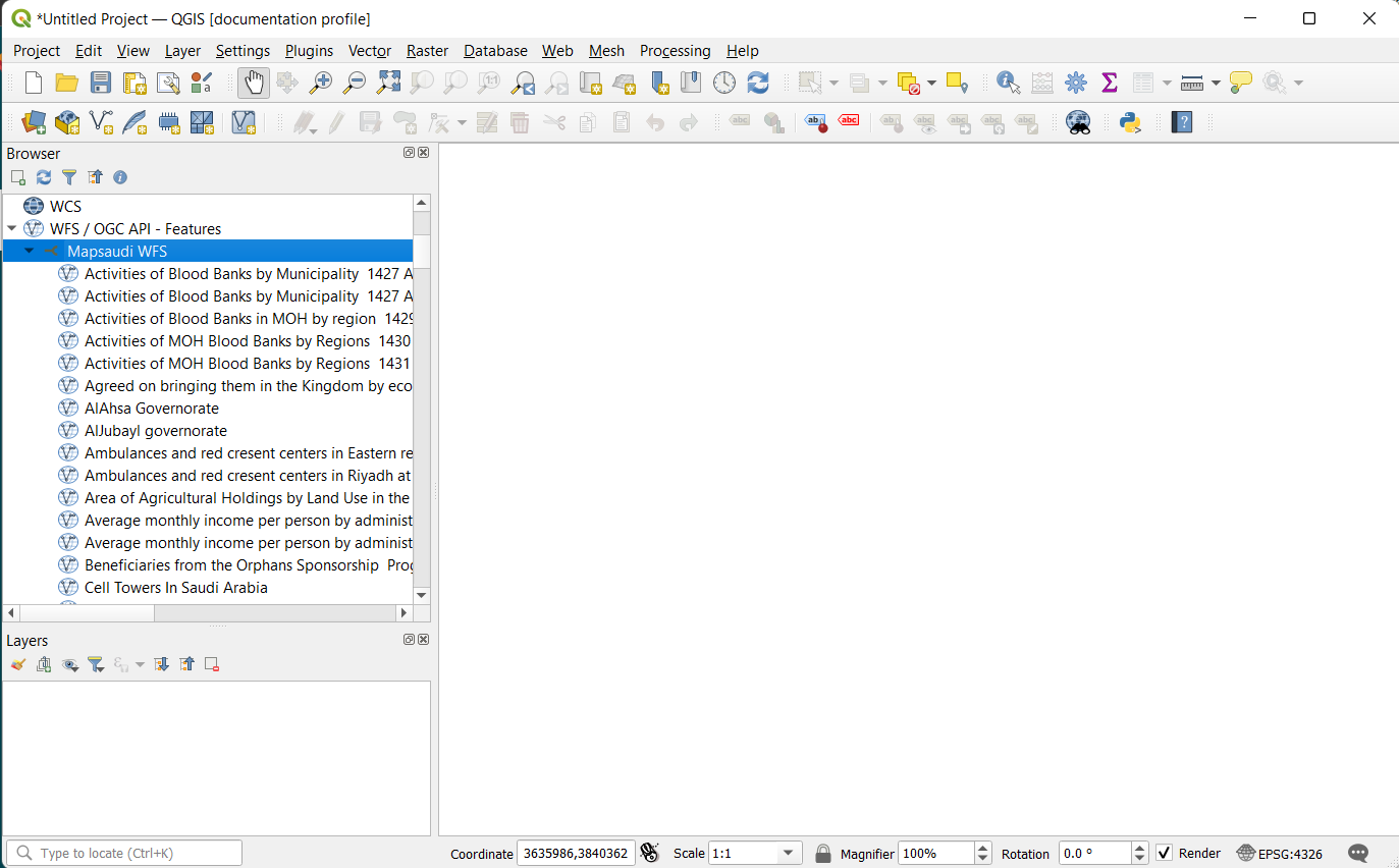
Open your WFS/OGC API-Features dropdown from you Browser Panel and find your new connection. You can open the tabaqat dropdown further to find the vector data categories
Step 4
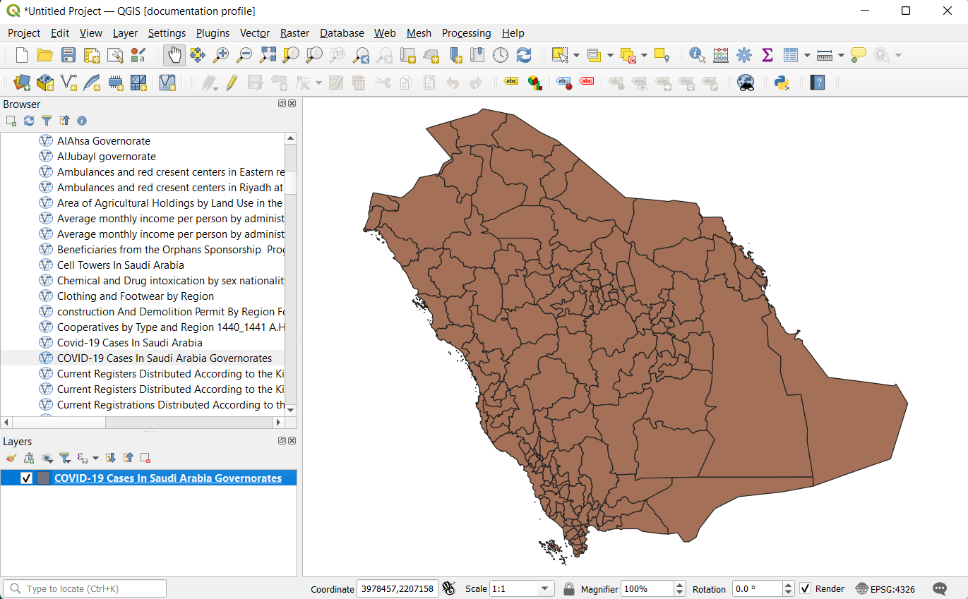
Open tabaqat dropdown from you Browser Panel with data categories. Double click on your layer and voilà.
Premium Step
You can do any selection, analysis, custom styling.
